Reality Capture Project Planning: Scope, Budgeting, and Site Preparation
Author: Allround Engineering · Spatial Reality Capture & Systems
Published: October 28, 2026 · Category: Project Planning & Budgeting
Procuring 3D laser scanning, Scan-to-BIM as-built models, and web-based digital twins for commercial construction or renovation projects frequently suffers from ambiguous Request for Proposal (RFP) scopes, over-specified Level of Development (LOD) requirements, and unprepared job sites that inflate surveying budgets by 40% to 120%. Transparent reality capture budgeting breaks down into four predictable engineering cost layers: equipment mobilization and geodetic control (€250–€650), square-meter field capture and point cloud registration (€0.35–€2.80/m² depending on floor area), and downstream deliverable modeling ranging from 2D CAD plans to LOD 200–350 BIM models (€1.20–€8.50/m²) and 60 FPS WebGL 3DGS digital twins. This engineering handbook equips real estate developers, property directors, quantity surveyors, general contractors, facility managers, and municipal project leads with a rigorous framework for drafting reality capture tenders, preventing scope creep, executing pre-scan site preparation, and satisfying Estonian Building Registry (EHR) and cadastral standards across Estonia, Latvia, and Finland.
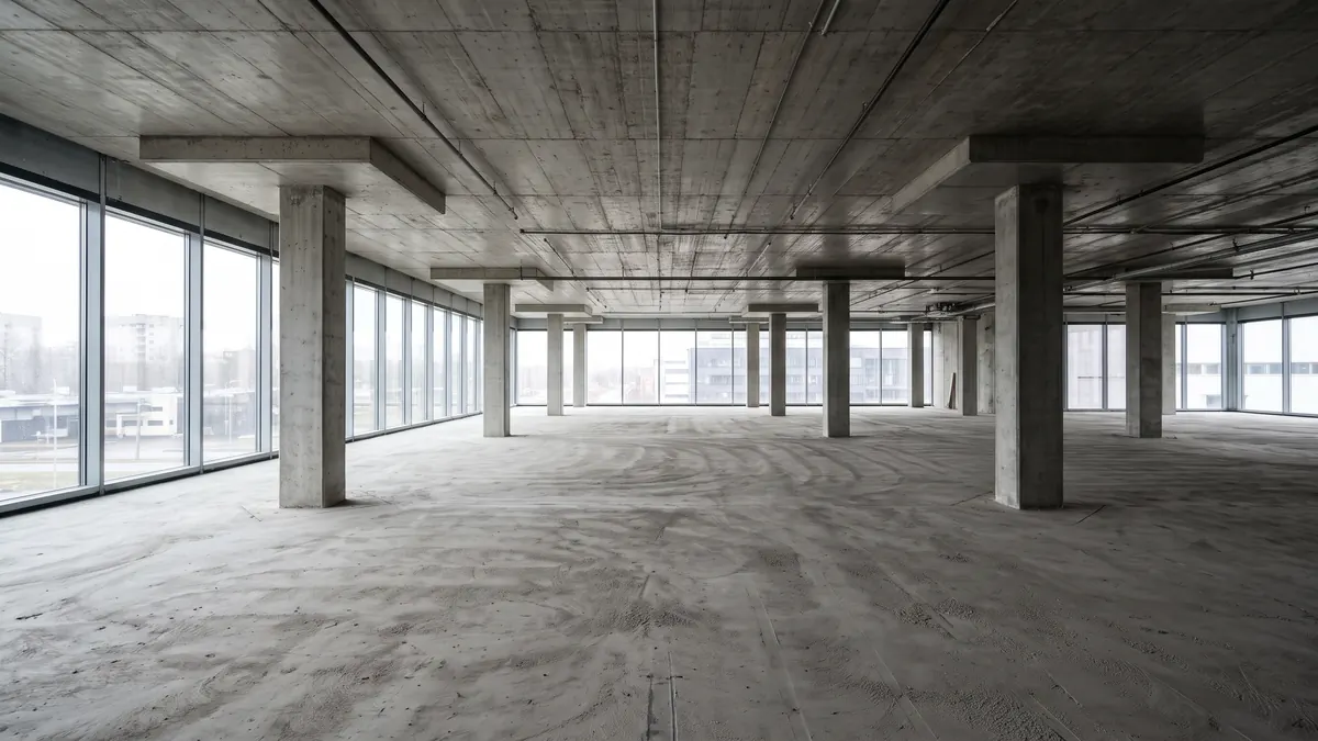
#Reality Capture Pricing Models: Fixed Project Fee vs. Square Meter Rate (€/m²)
Commercial Reality Capture Pricing Models follow two distinct structures: smaller or architecturally unique assets (under 800 m²) are priced as a Lump-Sum Fixed Project Fee ranging from €650 to €2,400, whereas mid-to-large commercial offices, retail centers, and industrial facilities (1,000 m² to 50,000+ m²) are budgeted using a Tiered Square Meter Rate (€/m²). Driven by field mobilization economies of scale, the unit cost for laser scanning and registered point cloud delivery drops from €2.20–€3.50/m² on compact heritage interiors down to €0.35–€0.85/m² across expansive logistics warehouses and manufacturing plants.
When quantity surveyors and project managers solicit three quotes for a "3D building scan" and receive bids ranging from €1,800 to €9,500, the discrepancy almost never reflects contractor margin — it reflects fundamentally different assumptions about deliverables (for a dedicated cost breakdown, see How Much Does a 3D LiDAR Survey Cost in Estonia? Breakdown of m² Pricing Factors). Comparing an uncleaned, local-coordinate point cloud against a georeferenced L-EST97 survey paired with an LOD 300 Revit model is comparing raw timber to finished cabinetry.
The 4 Cost Layers of Every Reality Capture Budget
1. Mobilization, Site Logistics & Geodetic Control Network (€250 – €650): Covers deployment of survey engineers and multi-sensor hardware (across Tallinn, Tartu, Pärnu, Narva, Riga, or Helsinki), placement of total-station Ground Control Points (GCPs) and checkerboard targets, and tying the site traverse into national geodetic datums.
2. On-Site Spatial Data Acquisition (€/m²): Governed by the selected sensor modality (detailed in our Spatial Reality Capture Guide). Mobile SLAM LiDAR captures 2,000–5,000 m² per hour, compressing field capture costs to €0.35–€1.10/m². Stationary Terrestrial Laser Scanning (TLS) requires tripod setups every 5–12 meters, taking 4–6x longer on site (€0.90–€2.80/m²) but delivering ±1.5–2.0 mm precision for structural steel fabrication and slab flatness audits.
3. Point Cloud Registration, Outlier Filtering & Indexing (15–25% of Budget): Office compute and engineering time required to align individual scan stations or SLAM trajectories via Iterative Closest Point (ICP) and loop-closure optimization, strip multipath mirror/glazing reflections and moving pedestrian noise, and export unified .e57, .rcp, and .laz archives (see Point Cloud Density, Noise, and Registration).
4. Downstream Engineering Deliverables — 2D CAD, Scan-to-BIM & 3DGS (50–70% of Total Investment): Translating registered point clouds into native .dwg floor plans, parametric .rvt/.pln/.ifc models, or 60 FPS interactive 3D digital twins on view.allround.ee is labor-intensive engineering work governed by room density and MEP complexity.
Building Complexity Tiers (Tier I – Tier IV) & Unit Rate Benchmarks (€/m²)
Two buildings with an identical 2,500 m² footprint can differ by 3.5x in scanning and BIM modeling hours depending on spatial compartmentalization. Allround classifies commercial and industrial assets into four standardized pricing tiers:
| Asset Complexity Tier | Architectural Typology & Spatial Characteristics | 3D Laser Scan + Point Cloud (€/m²) | 2D CAD Floor Plans & Sections (€/m²) | Scan-to-BIM LOD 200–300 (€/m²) | Scan-to-BIM LOD 350 + MEP (€/m²) |
|---|---|---|---|---|---|
| Tier I: Open Structural Shell & Logistics | Logistics warehouses, distribution halls, stripped commercial shells (shell & core), parking structures. Long sightlines, repetitive column grids. | €0.35 – €0.85 / m² | €0.50 – €1.10 / m² | €1.10 – €2.20 / m² | €2.40 – €4.10 / m² |
| Tier II: Standard Commercial & Residential | Class-A office floors, schools, clinics, apartment buildings, retail malls. Moderate partition density and standard suspended ceilings. | €0.75 – €1.50 / m² | €1.10 – €2.10 / m² | €2.20 – €4.20 / m² | €4.50 – €7.20 / m² |
| Tier III: Historic Heritage & Muinsuskaitse | Old Town limestone buildings, manor houses, timber villas, vaulted cellars, out-of-plumb walls, sagging joists, and ornate facades. | €1.30 – €2.60 / m² | €1.90 – €3.40 / m² | €3.80 – €6.50 / m² | €6.80 – €10.50 / m² |
| Tier IV: Congested Industrial & MEP Plant Rooms | Boiler houses, HVAC mechanical rooms, manufacturing lines, data centers, pumping stations (pipes ≥ Ø20 mm, cable trays, valves, flanges). | €1.80 – €3.50 / m² | €2.50 – €4.50 / m² | €5.00 – €8.50 / m² | €8.50 – €15.00+ / m² |
Note: Unit rates above apply to projects exceeding 1,000 m². For smaller assets (such as 150–500 m² heritage apartments, private villas, or standalone mechanical plant rooms), a minimum project engagement fee (starting at €650 + VAT) applies to cover mobilization, geodetic control, and QA processing.
#Scope Creep Mitigation & LOD Uplift: Specifying LOD 200 vs. 300 vs. 350 Without Overpaying
The single largest driver of budget overruns in Scan-to-BIM procurement is mandating a blanket LOD 350 or LOD 400 specification across an entire building, which multiplies modeling hours and cost by 1.8x to 3.2x without improving design coordination. Best-practice quantity surveying applies Zone-Based Hybrid LOD Scoping: modeling the primary architectural shell and structural grid at LOD 200–300 while restricting high-cost LOD 350 geometry (steel connection plates, flanges, and MEP conduits down to Ø25 mm) strictly to active tie-in zones and mechanical plant rooms.
When a tender document simply requests "a complete 3D BIM model of the existing building," bidders face a dilemma: either price a conservative LOD 350 model (making their bid look expensive) or price a basic LOD 200 shell and issue change orders later when the MEP engineer demands above-ceiling ductwork (explored in depth in Level of Detail (LOD 200 vs 300 vs 350): Specifying As-Built BIM Without Overpaying).
Matching LOD Tiers to Commercial Project Milestones
- LOD 200 (Feasibility, Space Planning & Area Audits — 1.0x Baseline): Walls, slabs, roofs, and columns are modeled as generalized volumetric placeholders (±15–25 mm tolerance). Doors and windows are represented as basic openings. Ideal for Gross/Net Leasable Area (GLA/NLA, BOMA, EVS 875) verification and early concept massing.
- LOD 300 (Architectural Renovation, Permit Submission & Clash Detection — 1.45x to 1.75x Multiplier): Accurate as-built geometry (±5–10 mm). Captures true wall thickness variations, out-of-plumb masonry deviations exceeding 15 mm, structural beam profiles, accurate window/door frame subdivisions, and primary MEP trunk lines (≥ Ø50 mm). LOD 300 is the optimal engineering baseline for 90% of commercial renovation projects.
- LOD 350 (Detailed Industrial Retrofits, Prefabrication & Dense MEP — 2.20x to 3.10x Multiplier): Models exact structural connections and secondary interfaces (±2–5 mm): steel baseplates, gusset plates, anchor bolts, pipe flanges, isolation valves, cable tray hangers, and small-bore piping (≥ Ø20–25 mm).
The 6-Point RFP Specification Template for Procurement Teams
Include these six explicit parameters in your Request for Proposal (RFP) to guarantee apples-to-apples bidding and zero post-contract scope creep:
1. Exact Spatial Boundary & Gross Floor Area (m²): Define whether the scope covers interior floors only, or includes basements, attic truss spaces, roof surfaces, and exterior facades (and whether drone photogrammetry is required for roof geometry).
2. Coordinate System & Vertical Datum: Specify whether a local project origin (0, 0, 0) suffices or if national L-EST97 (EPSG:3301) planar coordinates and EH2000 elevations are mandatory (required for municipal permits and site utility tie-ins).
3. Minimum MEP Modeling Cutoff Size: Define the exact diameter threshold (e.g., "Model all pipes, ducts, and cable trays ≥ Ø50 mm in BIM; conduits under Ø50 mm shall remain documented visually inside the registered point cloud and 3DGS viewer").
4. Suspended Ceiling Plenum & Raised Floor Scope: State whether above-ceiling voids (plenums) must be scanned and modeled, and specify the spacing of opened ceiling tiles.
5. Native Software Version & Deliverable Formats: Specify exact authoring versions (e.g., Autodesk Revit 2025 .rvt, Graphisoft ArchiCAD 28 .pln), open IFC4 Reference View, 2D .dwg/.pdf sheets, and point cloud containers (.e57 / .rcp).
6. Quantitative QA Acceptance Tolerances: Specify maximum permissible registration RMS error (≤ 3 mm) and point-cloud-to-BIM modeling deviation (≤ 10 mm for primary structure, ≤ 15 mm for architectural finishes).
#Site Readiness Protocol: Preparing Your Property to Eliminate Remobilization Fees
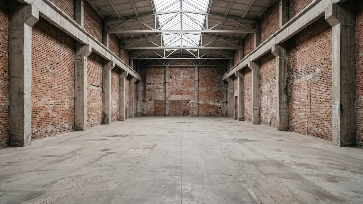
An unprepared job site — characterized by unlit rooms, locked mechanical doors, unopened suspended ceiling tiles, or sightlines blocked by construction material pallets — reduces field scanning productivity by 35–60% and creates data shadows (occlusions) that can trigger a €350–€800 remobilization visit. Executing Allround's 6-Step Site Readiness Protocol prior to technician arrival compresses on-site time to a minimum and guarantees 100% spatial and visual coverage on the first deployment.
Laser scanners and 3DGS camera arrays are strictly line-of-sight optical instruments (see our downloadable field guide Job Site Readiness Checklist: What Must Happen Before a Scanning Technician Arrives). Neither a LiDAR pulse nor a camera lens can penetrate drywall stacks, plastic dust curtains, or locked fire doors. When temporary scaffolding or debris obscures structural wall-to-slab junctions, BIM engineers are forced to interpolate missing geometry.
The 6-Point Pre-Scan Checklist for Site Superintendents & Facility Managers
1. Clear Optical Sightlines & Floor Surfaces: When commissioning a concrete floor flatness and deflection audit (ASTM E1155 / FF-FL) or structural as-built survey, sweep the slab free of debris, standing water, cable spools, and pallet stacks. Pull stored materials at least 1.2 meters away from perimeter walls and columns so the laser captures the true structural base.
2. Uniform Illumination (≥ 150–300 Lux): While active LiDAR sensors measure geometry in total darkness, capturing high-dynamic-range RGB point cloud colorization and photorealistic 3D Gaussian Splatting (3DGS) radiance fields requires consistent lighting (see Indoor vs. Outdoor Capture Challenges: Overcoming Reflective Glass, Low Light, and Foliage). Turn on all interior lighting circuits prior to arrival; if permanent power is disconnected on a construction site, notify the survey team in advance so battery-powered 360° diffused LED site towers can be deployed.
3. Pre-Opened Ceiling Plenum Tiles: If your scope includes above-ceiling MEP documentation (HVAC ductwork, chilled water pipes, fire sprinklers, cable trays), instruct site maintenance staff to slide open one acoustic ceiling tile every 4 to 6 meters (and unlock service hatches) before the scanning crew arrives.
4. Master Key & Security Escort Protocol (Zero Locked Doors): Mobile SLAM LiDAR relies on continuous trajectory loops (Loop Closure) through corridors, stairwells, and adjacent rooms to eliminate drift. Waiting 45 minutes for a security guard to unlock a rooftop mechanical room or electrical substation breaks the mathematical trajectory. Assign an on-site contact equipped with a Master Key / Access Card for every room in the scope.
5. Mirrors, Glazing & Operational Quiet Windows: Floor-to-ceiling mirrors cause laser multipath reflections (creating virtual "ghost rooms" behind the glass), while moving forklifts, pedestrians, and vibrating machinery introduce point cloud noise. Cover large mirrors with temporary masking paper where feasible, and schedule commercial office or retail scans during off-peak hours (evenings or weekends).
6. Airborne Dust Control & HSE Compliance: Active concrete grinding, demolition, or drywall sanding fills the air with particulate dust that scatters laser beams and fouls optical lenses. Halt dust-generating activities in the scan zone at least 30–60 minutes before capture begins. Allround field engineers arrive with full PPE (hard hats, S3 safety footwear, high-visibility vests, eye protection, FFP3 respirators) and complete site-specific HSE inductions prior to work.
#Estonian Building Registry (EHR) & Cadastral Compliance: Aligning Reality Capture with Regulations
For construction, renovation, and retrospective legalization (seadustamine) projects in Estonia, 3D reality capture deliverables and derived architectural drawings must comply with the Estonian Building Code (Ehitusseadustik), Ministry of Economic Affairs and Communications (MKM) regulations, EVS 932 building design standards, and Estonian Land and Spatial Development Board (Maa- ja Ruumiamet / Maa-amet) geodetic requirements. Allround anchors all statutory as-built surveys to the national L-EST97 (EPSG:3301) planar coordinate system and EH2000 vertical height system to ±2 mm to ±10 mm precision, ensuring frictionless approval in the Estonian Building Registry (Ehitusregister — EHR) for building permits (ehitusluba) and occupancy/usage permits (kasutusluba).
For international real estate funds, local developers, industrial operators, and municipal authorities, authoritative spatial documentation is frequently the fastest path to resolving regulatory bottlenecks during property transactions or refinancing (explored in detail in Estonian Building Registry (EHR) & Cadastral Compliance: Aligning Reality Capture with Regulations).
3 High-Impact Regulatory Workflows Powered by 3D Laser Scanning
1. Occupancy Permits (Kasutusluba) & Retrospective Building Audits (Ehitise Audit): Hundreds of commercial, industrial, and residential properties constructed or modified between 1995 and 2020 lack valid occupancy permits in the Estonian Building Registry because legacy paper blueprints were lost or unrecorded tenant alterations changed fire compartments, load-bearing openings, or net floor areas. A single-day Mobile SLAM LiDAR and TLS deployment captures the entire building's ground truth, enabling rapid generation of EHR-compliant floor plans, cross-sections, elevations, and certified area schedules (suletud netopind, heated area, building footprint, and gross volume).
2. National Heritage Conservation (Muinsuskaitseamet Approvals): Across UNESCO-protected Tallinn Old Town and heritage conservation zones in Tartu, Viljandi, Pärnu, Kuressaare, and Haapsalu, the National Heritage Board mandates comprehensive pre-renovation documentation before structural interventions (see Heritage Conservation & Renovation: Sub-Centimeter Reality Capture for Historic Buildings). Combining millimeter LiDAR point clouds with photorealistic 3DGS radiance fields satisfies both structural deformation mapping and archival visual preservation in a single field deployment.
3. Automated EHR BIM Permit Validation (IFC4 Compliance): Estonia's digital Building Registry (EHR) incorporates automated IFC BIM model validation for building permit submissions, checking spatial hierarchy, storey elevations, fire egress dimensions, and technical area metrics directly from the 3D file. Allround structures all Scan-to-BIM deliverables with standardized IfcProject, IfcSite, IfcBuilding, IfcBuildingStorey, and IfcSpace entities georeferenced via IfcMapConversion to L-EST97 / EH2000.
#As-Built Survey Deliverables Package & Transparent Pricing Matrix: Heritage Loft (300 m²) vs. Class-A Office (2,500 m²) vs. Logistics Warehouse (12,000 m²)
A complete As-Built Survey Deliverables Package combines archival geodetic ground truth (registered .e57 / .rcp point clouds), production design files (2D .dwg/.pdf drawings and LOD 200–350 .rvt/.pln/.ifc BIM models), and a stakeholder-ready 60 FPS WebGL 3DGS digital twin (view.allround.ee). Across Baltic and Nordic AEC benchmarks, investing in a complete 3D reality capture and Scan-to-BIM package represents just 0.15% to 0.40% of total construction or retrofit capital expenditure, while eliminating on-site MEP clashes and dimensional rework that typically consume 5% to 12% of project budgets.
To provide quantity surveyors, property directors, and project managers with a transparent budgeting baseline (see also 3D File Formats Decoded: E57, LAS/LAZ, PLY, and SPZ Explained for Clients and Engineers), the matrix below details real-world scope calculations, turnaround timelines, and total investment across three representative architectural archetypes in Estonia, Latvia, and Finland.
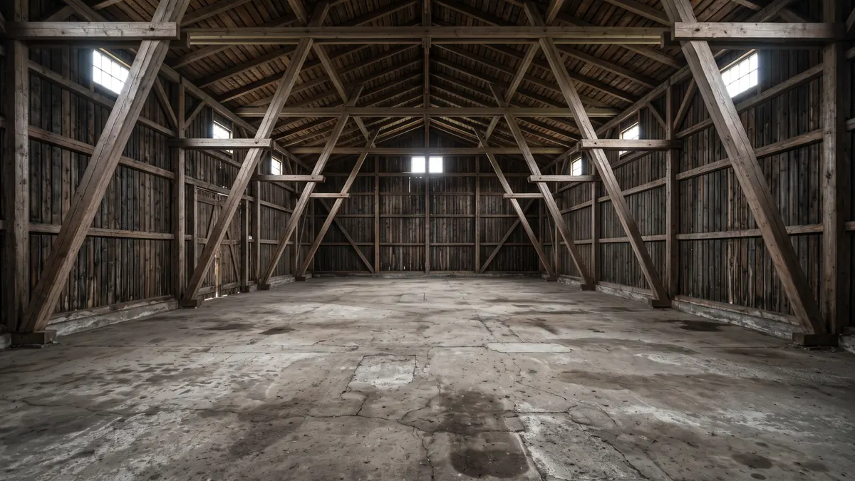
Figure 3: Wide-span industrial and logistics warehouse structural shell. On open-bay facilities exceeding 10,000 m² (Tier I), Mobile SLAM LiDAR economies of scale reduce base scanning and registered point cloud unit costs to €0.35–€0.65/m².
Side-by-Side Pricing & Scope Calculation Matrix: 3 Real-World Project Archetypes
| Scope & Budget Parameter | 1. Residential Heritage Loft (~300 m²) Tier III · Kalamaja / Old Town |
2. Class-A Commercial Office (~2,500 m²) Tier II · Kristiine / Ülemiste |
3. Industrial Logistics & Plant (~12,000 m²) Tier I/IV · Rae / Rakvere / Pärnu |
|---|---|---|---|
| Commercial Objective & Brief | Historic timber/limestone attic conversion, architectural design baseline & EHR usage permit | Multi-tenant commercial office fit-out, glass partition layout & ceiling MEP coordination | Production line retrofit, 800 m² boiler house upgrade & warehouse slab flatness audit |
| Capture Methodology | Hybrid Mobile SLAM LiDAR + HDR 3DGS capture | Mobile SLAM LiDAR + TLS control stations + 3DGS | High-speed SLAM LiDAR (11,200 m² hall) + precision TLS (800 m² plant room) |
| On-Site Field Duration | 2.5 – 3.5 hours (1 survey engineer) | 1 work day (6 – 8 hours) (2 engineers, incl. ceiling plenum scans) | 1.5 – 2 work days (12 – 16 hours) (2 engineers, zero production downtime) |
| Mobilization & Geodetic Control | €250 (local + L-EST97 tie-in) | €380 (total station GCP targets, L-EST97 / EH2000) | €550 (exterior & interior geodetic traverse, L-EST97 / EH2000) |
Base Scanning + Registered Point Cloud (.e57 / .rcp) |
€550 (total with mobilization: €800 or €2.67/m²) | €2,120 (total with mobilization: €2,500 or €1.00/m²) | €5,450 (total with mobilization: €6,000 or €0.50/m²) |
Option A: 2D CAD Floor Plans, Sections & Elevations (EHR / .dwg / .pdf) |
+ €650 (€2.17/m²) | + €2,750 (€1.10/m²) | + €6,600 (€0.55/m² + slab elevation heatmap) |
| Option B: Scan-to-BIM Model — LOD 200 (Architectural Shell) | + €750 (€2.50/m²) | + €3,750 (€1.50/m²) | + €10,800 (€0.90/m²) |
| Option C: Scan-to-BIM Model — LOD 300 (Arch + Structure + MEP ≥ Ø50mm) | + €1,250 (€4.17/m² — incl. sloped rafters & bowed masonry) | + €6,500 (€2.60/m² — complete design coordination baseline) | + €19,200 (€1.60/m² — warehouse structure + main trunk lines) |
| Option D: Scan-to-BIM Model — LOD 350 (Dense MEP ≥ Ø25mm + Steel Connections) | + €1,950 (€6.50/m²) | + €11,250 (€4.50/m² — full above-ceiling MEP modeling) | + €26,400 (€2.20/m² — hybrid: hall at LOD 300 + 800 m² plant room at LOD 350) |
Interactive 60 FPS 3DGS Digital Twin (view.allround.ee) |
+ €450 (virtual design review & pre-sales) | + €1,400 (remote BIM coordination & tenant leasing) | + €3,200 (facility management FM twin & remote engineering audit) |
| Turnaround Timeline (Point Cloud / Completed BIM) | 2 business days (point cloud) / 5–7 business days (BIM / CAD) | 2–3 business days (point cloud) / 8–12 business days (LOD 300 BIM) | 3–4 business days (point cloud) / 14–20 business days (hybrid BIM) |
| Recommended Turnkey Investment (Scan + Optimal LOD 300 BIM + 3DGS) | €2,500 (blended rate: €8.33/m²) | €10,400 (blended rate: €4.16/m²) | €28,400 (blended rate: €2.37/m²) |
All figures above are exclusive of VAT. Fixed-price project quotations are issued within 24 hours upon review of site location, approximate gross floor area, and required deliverable tiers.
Standard Handover Deliverables & QA Certification Matrix
| Deliverable Component | File Formats & Industry Standards | Engineering Scope & Downstream Application |
|---|---|---|
| 1. Registered Point Cloud Archive | .e57 (ASTM E2807), .rcp / .rcs (Autodesk ReCap), .laz (ASPRS 1.4) |
Noise-filtered, unified, spatially decimated (5 mm or 10 mm grid), and georeferenced to L-EST97 / EH2000. |
| 2. Parametric As-Built BIM Model | .rvt (Revit 2024–2026), .pln (ArchiCAD 27–28), .ifc (IFC 2x3 / IFC4) |
Native parametric families for walls, slabs, columns, trusses, ductwork, and piping modeled to LOD 200–350. |
| 3. 2D CAD Documentation & EHR Set | .dwg (AutoCAD 2018+), .pdf (plotted A1–A3 sheets), .xlsx (area schedules) |
Dimensioned floor plans, longitudinal/cross sections, facade elevations, and certified net area tables for EHR permits. |
| 4. QA Registration & Deviation Report | Color elevation heatmap (.pdf / .tiff), .csv deviation log, RMS certificate |
Geodetic control residual report (RMS ≤ 2–5 mm) and floor flatness / wall plumb contour maps (0.5–2.0 mm intervals). |
| 5. Interactive 3DGS Digital Twin | Hosted URL view.allround.ee/:slug + archival .sog / .spz / .ply |
Zero-latency 60 FPS browser-based volumetric twin with built-in 3D point-to-point measurement and section clipping. |
#Related Engineering Handbooks & Deep Dives
This cornerstone handbook anchors Allround's commercial and regulatory library on project planning, budgeting, and cadastral compliance. Explore our specialized deep-dive guides and companion engineering handbooks below.
Specialized Deep Dives in Budgeting, Site Readiness & Cadastral Compliance
| Specialized Technical Guide | Commercial & Regulatory Focus |
|---|---|
| How Much Does a 3D LiDAR Survey Cost in Estonia? Breakdown of m² Pricing Factors | Granular analysis of square-meter rates (€0.80–€3.50/m²), mobilization fees, LOD uplift multipliers, and sample quotations. |
| Job Site Readiness Checklist: What Must Happen Before a Scanning Technician Arrives | Actionable pre-deployment protocol for site superintendents: illumination, sightline clearing, ceiling plenum access, and HSE safety. |
| Estonian Building Registry (EHR) & Cadastral Compliance: Aligning Reality Capture with Regulations | As-built documentation for occupancy permits (kasutusluba), retrospective building audits, and L-EST97 / EH2000 compliance. |
| Terrestrial Laser Scanning vs. Drone Photogrammetry: Which Method Fits Your Asset? | Combining indoor SLAM/TLS laser scanning with RTK drone photogrammetry for complete roof, facade, and interior models. |
Companion Allround Engineering Handbooks
| Handbook Title & Direct Link | Core Engineering Focus & Deliverables |
|---|---|
| Spatial Reality Capture Guide: LiDAR, Photogrammetry & 3DGS | Comparing Terrestrial Laser Scanning (TLS), Mobile SLAM LiDAR, and 3DGS radiance fields for AEC site verification. |
| Scan-to-BIM & As-Built Modeling: The Complete Practical Handbook | Translating registered laser point clouds into parametric Revit, ArchiCAD, and open IFC models at LOD 200–350. |
| Interactive 3D & Digital Twins on the Web: 3DGS and WebGL in Architecture | Streaming multi-million 3D Gaussian Splatting scenes in web browsers at 60 FPS via SOG/SPZ compression and Octree LoD. |
Ready to scope and budget your next 3D laser scanning, Scan-to-BIM, or digital twin deployment across Estonia, Latvia, or Finland? Contact the Allround engineering team at view@allround.ee or review our services and projects.